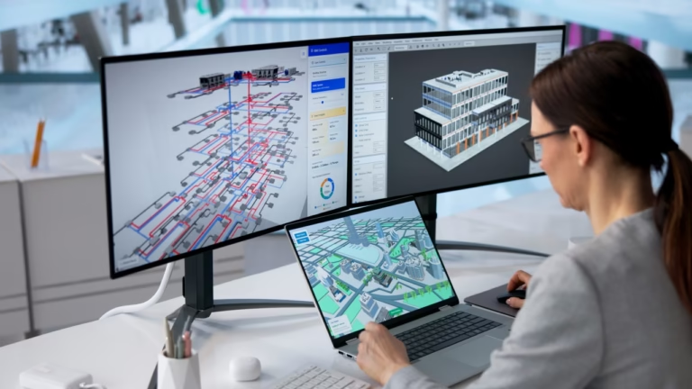
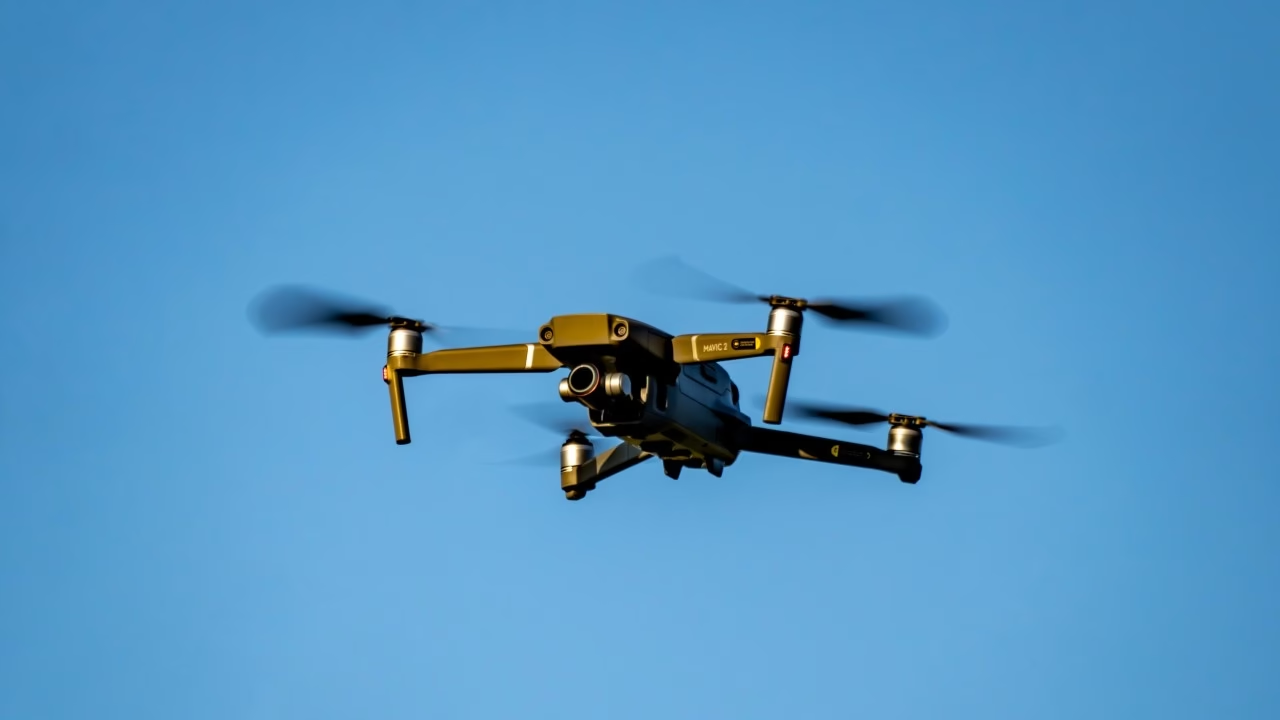
Construction drones are becoming powerful data-collection instruments. But drone data alone does not control a project.
The real value begins when images, point clouds, quantities, inspection findings and geospatial data are connected with the project’s Bill of Quantities (BoQ), Work Breakdown Structure (WBS), schedule, cost codes, resources, machinery, vessels, contracts and actual expenditure.
That is the difference between reality capture and reality-based project control.
A recent analysis of the Japan construction drone market identifies several trends accelerating drone adoption: automated site mapping, surveying, infrastructure inspection, AI-powered image processing, real-time progress tracking, BIM interoperability and predictive maintenance.
Japan is particularly relevant. The Ministry of Land, Infrastructure, Transport and Tourism’s i-Construction program has promoted UAV surveying and 3D data throughout surveying, construction and inspection workflows. Japanese guidance specifically recognizes drone photogrammetry for high-density 3D surveying and the use of 3D data to calculate construction quantities and support ICT-enabled construction.
The next step is bigger:
Connect what the drone sees with what the enterprise knows.
What Is the Missing Link Between Construction Drones and ERP?
A drone can tell you what exists at a particular location and point in time.
An ERP should tell you what that observation means to the project.
Modern UAV workflows can generate high-resolution imagery, orthomosaics, point clouds, terrain models, volumetric measurements, thermal imagery and increasingly AI-classified observations.
Academic research has already demonstrated the value of combining UAV photogrammetry with BIM. A systematic review of UAV technologies in construction found progress monitoring to be one of the dominant applications, commonly using drone imagery to create an as-built 3D model and comparing it with the planned model.
More recent research goes further. A 2026 study integrating UAV photogrammetry, BIM and automated point-cloud comparison demonstrated quantitative assessment of completed, ongoing and pending works while identifying schedule deviations.
But there is still a fundamental enterprise question:
Progress against what?
- A 3D model can identify that an object exists.
- A schedule can indicate that an activity should be complete.
Neither, by itself, explains whether the corresponding quantities have been earned, whether the resources consumed were reasonable, whether subcontractors should be certified, or whether actual cost is aligned with physical progress.
This is where ProjectVIEW ERP changes the equation.
Drone Data Should Ultimately Become a Project Transaction
ProjectVIEW ERP is built around the relationship:
BoQ ↔ WBS ↔ Cost Codes
The BoQ represents contractual and measurable scope.
The WBS represents activities, sequence and time.
Cost Codes represent how the enterprise categorizes and controls expenditure.
ProjectVIEW ERP associates operational transactions with these dimensions so that physical execution can be compared with the project baseline. Its construction environment includes progress monitoring, machinery management, materials, procurement, subcontractors, labor productivity, site applications and integration with scheduling and BIM environments.
The objective of integrating drone-derived data should therefore not be to create another dashboard.
It should be to transform observed reality into structured evidence supporting ERP transactions.
A practical data chain can look like this:
- Capture reality: UAVs, fixed cameras, mobile devices, LiDAR, GNSS, machinery telematics, IoT sensors and, where relevant, ROV/AUV systems collect field evidence.
- Interpret reality: Photogrammetry, computer vision and AI identify quantities, assets, conditions, objects, defects, progress or anomalies.
- Contextualize reality: BIM, GIS and project coding locate the observation against the relevant asset, area, BoQ item or WBS activity.
- Reconcile reality: ProjectVIEW ERP compares observed progress with scheduled progress, budgeted resources, actual labor, machinery, materials, subcontractors and cost.
- Act on reality: ProjectVIEW workflows trigger review, inspection, approval, corrective action, maintenance, certification, forecasting or management alerts.
The drone becomes an additional field observer. ProjectVIEW becomes the operational system of record. AI becomes the interpretation and reasoning layer.
Can Drone Data Complete the Construction Daily Log?
It can substantially strengthen it—but it should supplement, not blindly replace, controlled field reporting.
A construction daily log traditionally depends on information entered by supervisors, engineers, timekeepers, plant managers, subcontractors and other site personnel.
ProjectVIEW already structures site and yard information around progress, labor productivity, materials consumption, machinery utilization, inspections, work orders and other operational records. DANAOS specifically describes digitized contractor daily logs as a means of improving real-time project visibility and coordination.
Now imagine supplementing that human record with machine-generated evidence.
- A progress entry stating that excavation reached a particular quantity can be cross-checked against a UAV-derived terrain model.
- A stockpile quantity can be compared with warehouse and materials records.
- Concrete, steel, piping or structural progress can be compared against imagery, BIM objects and corresponding BoQ items.
- An inspection request can include georeferenced imagery captured shortly before submission.
AI can identify discrepancies between yesterday’s and today’s images, highlight areas requiring human verification and prepare a structured draft of the daily construction report.
The result is not “AI replacing the site engineer.”
It is a better evidence chain.
Why Heavy Machinery Utilization Is Critical in Construction and Mining
In construction and mining, production is inseparable from machinery.
Excavators, loaders, dump trucks, dozers, graders, cranes, drilling rigs and other heavy assets are not simply equipment on an asset register. They are productive resources whose time, availability, utilization, fuel and maintenance directly influence unit cost and production rates.
Recent research on earthmoving fleet monitoring shows that GNSS and telematics can classify working versus idle states, analyze equipment cycles and support real-time productivity assessment.
Caterpillar similarly combines telematics information such as utilization, fuel consumption and work-versus-idle time with inspections and maintenance history to understand equipment performance and health.
Komatsu’s Smart Construction ecosystem demonstrates the same broader direction: design information, machine-generated as-built data and drone aerial mapping can be combined to visualize progress and quantities.
ProjectVIEW ERP takes this operational information into the project-management and cost-control environment. Its Machinery Management capabilities include working and idle hourly cost, machinery scheduling and allocation, logistics and mobilization, preventive and corrective maintenance, daily machinery utilization linked to BoQ structures and machinery telematics.
This is particularly important in mining and quarrying, where the relationship between excavator productivity, truck cycles, loading efficiency, haul routes, fuel consumption, equipment availability and production tonnage can determine the economics of the entire operation.
Knowing where an excavator is located is useful.
Knowing whether it was productive is better.
Knowing what quantity it produced, for which activity, at what cost and against which budget is enterprise control.
From Machinery Fleet Management to Vessel Fleet Management
The same principle extends offshore.
Marine construction, offshore energy and shipyard operations add another class of capital-intensive resources: vessels.
Tugs, barges, dredgers, crane vessels, crew boats, supply vessels, jack-ups, installation vessels and other floating assets participate directly in project execution.
Their mobilization, operating hours, fuel, availability, weather exposure, maintenance, inspections and downtime can materially affect project cost and schedule.
DANAOS ProjectVIEW ERP addresses marine and offshore operations across yards, sites and vessels, including vessel mobilization scheduling, fleet and equipment management, maintenance logs and integration with project logistics and cost centers.
This matters because fleet activity should not exist outside the project’s daily operational record.
A vessel supporting a WBS activity offshore is consuming time and money just as an excavator supporting an earthworks activity is consuming time and money on land.
Both should ultimately contribute to the same operational truth.
Can Drones Be Used for Marine and Offshore Inspection?
Yes—but with an important technical distinction.
Aerial and confined-space drones are increasingly used for visual inspection of ships and offshore structures. DNV has used drone-assisted surveys for ballast and cargo tanks, cargo holds, jack-up legs and structural components of maritime and offshore installations.
DNV research is also combining drones, LiDAR and AI for remote ship-hull inspection, including identifying potential cracks and corrosion for closer human assessment.
This can reduce the need for scaffolding, staging and hazardous human access. DNV has also demonstrated drone inspection on offshore floating assets, including an FPSO tank where captured video was processed by an algorithm to detect potential structural cracking.
But aerial drones do not replace subsea inspection.
Below the waterline, Remotely Operated Vehicles (ROVs), Autonomous Underwater Vehicles (AUVs), sonar and underwater inspection systems become part of the same broader reality-capture architecture. Lloyd’s Register explicitly recognizes UAVs, drones, ROVs, robotic systems and other remote inspection techniques for appropriate survey applications.
The enterprise opportunity is to bring evidence from above water, below water, onboard and ashore into one governed operational environment.
Why ProjectVIEW ERP + AI Changes the Value of Reality Capture
AI becomes genuinely valuable when it has context.
An AI model looking at a drone image may identify a machine, concrete element, stockpile, pipe, corrosion area or incomplete structure.
ProjectVIEW provides the missing business context:
Which project? Which BoQ? Which WBS activity? Which location? Which subcontractor? Which machine or vessel? Which inspection? Which budget? Which cost account? Which planned completion date?
That context allows ProjectVIEW AI to move beyond image classification toward operational reasoning.
DANAOS defines ProjectVIEW OS as ProjectVIEW ERP—the process and data layer—combined with ProjectVIEW AI—the intelligence and autonomy layer, with BoQ–WBS–Cost Code connectivity providing a structured project foundation for AI analysis.
That architecture creates the possibility of AI-assisted deviation detection, inspection prioritization, productivity analysis, maintenance alerts, progress validation, forecasting and automated reporting based on structured project reality rather than isolated images or generic prompts.
The Future Is Not Drone Management. It Is Integrated Reality Management.
Construction technology is accumulating sensors everywhere.
- Drones see the project from above.
- Site personnel report what happened on the ground.
- Machinery telematics records how equipment was operated.
- BIM describes what should exist.
- Primavera defines when activities should happen.
- ROVs and inspection robots can document difficult or submerged environments.
- Vessels generate operational, maintenance and mobilization records.
The mistake is allowing every technology to create another isolated data silo.
Real digital construction begins when these data streams converge around the same project structure.
For DANAOS Projects, that structure is ProjectVIEW ERP.
The long-term objective is straightforward:
Site + Yard + Machinery + Vessel + Drone + BIM + Schedule + AI → ONE operational truth.
Because collecting more data does not automatically create control.
Connecting reality to scope, time, resources and cost does.
Frequently Asked Questions
How can construction drone data integrate with an ERP system?
Drone imagery, point clouds, measurements and inspection data can be processed through photogrammetry, BIM, GIS or AI platforms and then exchanged with an ERP through APIs, structured files or integration services. In ProjectVIEW ERP, the business objective is to associate validated information with the relevant project, BoQ, WBS, Cost Code, resource, asset, inspection or operational transaction.
Can drones automatically measure construction progress?
UAV photogrammetry and AI can automate significant portions of progress measurement, particularly where quantities or physical geometry can be reliably observed. Research demonstrates the comparison of drone-generated as-built models with planned BIM models. Human validation remains important, particularly for contractual certification, concealed works and activities that cannot be reliably observed remotely.
Why should drone data be connected with machinery and labor data?
Physical progress alone does not reveal productivity or cost performance. A contractor must understand the resources consumed to achieve that progress. Connecting observed quantities with labor hours, machinery hours, materials and subcontractor transactions allows management to assess whether production is economically aligned with the project baseline.
How can AI improve drone-based construction monitoring?
AI can classify imagery, identify objects and anomalies, compare changes between capture periods, prioritize inspections and help convert unstructured visual evidence into structured operational information. When combined with an ERP, AI can additionally analyze those observations within project cost, schedule, procurement, resource and contractual context.
How does this apply to marine and offshore construction?
The same model applies across yards, vessels and offshore assets. Aerial drones can inspect accessible structures and hard-to-reach areas, while ROVs and other remote inspection technologies extend data capture below the waterline. When inspection, vessel, equipment and project records are connected, the organization gains a more complete operations and maintenance history.
References and Further Reading
Japan construction drone market analysis: Optiusd Group, Japan Construction Drone Market Regional Size, Trends and Forecast to 2033. Read the LinkedIn market article
Japan i-Construction and UAV surveying: Ministry of Land, Infrastructure, Transport and Tourism / Geospatial Information Authority of Japan. MLIT i-Construction guidance GSI 3D mapping and UAV guidance
Academic research: Unmanned Aerial Vehicles Integration with Digital Technologies toward Construction 4.0, Sustainability. Read the systematic literature review
UAV + BIM progress monitoring: Integrated Information System for Periodic Construction Progress Monitoring: Utilizing UAV, Photogrammetry, and BIM, Civil Engineering Sciences, 2026. Read the research article
Heavy-equipment utilization: Caterpillar Fleet Management and Komatsu Smart Construction. Caterpillar equipment utilization Komatsu Smart Construction Dashboard
Marine and offshore drone inspections: DNV remote and drone-assisted ship surveys. DNV drone surveys
DANAOS ProjectVIEW ERP: ProjectVIEW ERP and ProjectVIEW AI Operating System
Marine and offshore operations: ProjectVIEW ERP for marine construction and upstream operations